
Contagious Cartography
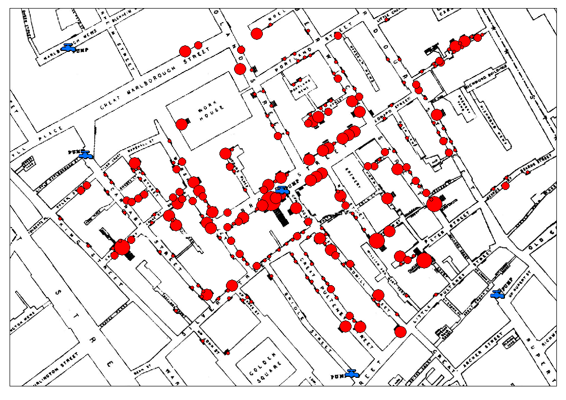
For centuries, humans have been tracking the spread and impact of disease, collecting data, and finding insights to understand the disease. Since the 19th century, maps have been critical in helping us understand the spread of infectious diseases. When the COVID-19 pandemic hit, there was an increased interest in collecting and consuming disease data. This hands-on workshop by information designer Rasagy Sharma, and data- journalist Sriharsha Devulapalli, dove deeper into how maps in the past helped us understand diseases. Participants also got to create their own interactive maps to explore and narrate stories about deadly diseases.

About the Data Journalist
Sriharsha Devulapalli is the Product Lead at Blue Sky Analytics. Prior to this, he was a data journalist with Mint. He also has worked with the Urban Design Lab, Small Media, and the Hyderabad Urban Lab. He enjoys cities, maps, long walks, and making people curious.

About the Information Designer
Rasagy Sharma is an Information Designer, Data Artist and Compulsive Sketchnoter. He is currently working as a Product Designer at Sundial, and in the past created visualizations and designed products at Gramener, Mapbox, Microsoft and Barclays. He creates data art in search of meaning and uses sketchnotes to listen and comprehend information. He holds a M.Des. in Information & Interface Design from National Institute of Design, Bangalore and B.E. in Computer Science from Birla Institute of Technology and Science Pilani, Goa Campus.