
A Game on Earth
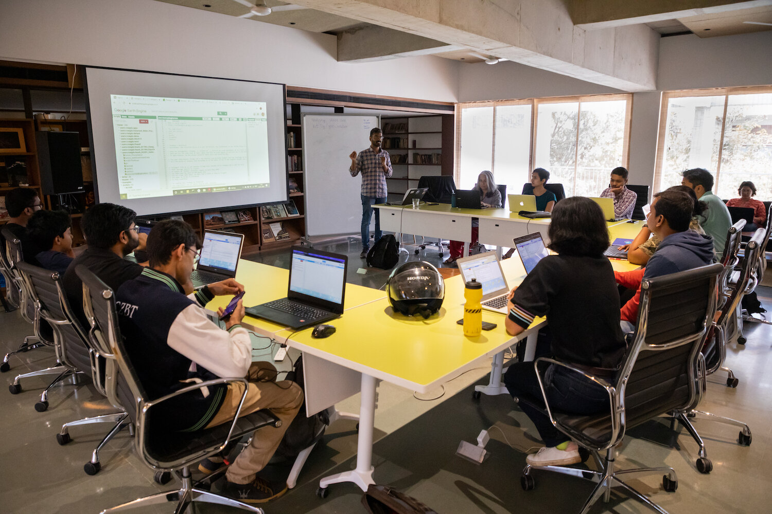
All that I knew about Deep Dive was that Pradeep was looking for a village that could not be located on a map; the people of the village sought help from the one man, who they thought, could save it. As I entered the room where the workshop facilitated by Craig D’s Souza, which was organized as a part of Science Gallery Bengaluru’s exhibition on water, I noticed that all the participants were staring intently at their screens.
Craig is an independent researcher, who uses code to address issues related to water resources and works on making information about it more accessible to the public. He believes that teaching common people how to code and handle data can be very empowering to people who want to make a change. The workshop was very much in tune with that belief. It highlighted how to use open source data on water through a game.
The game was simple. We had to find where Pradeep is and help him locate a village using Google Earth Engine, which is a cloud-based program that lets users retrieve and analyze Earth’s topological data. This has real world applications such as spotting areas with depleting water resources. The encrypted message that we had received told us that the village was located near a big city and its inhabitants faced a water shortage crisis. We had to find them in six hours. We knew that without our intervention, the lives of the villagers would be in dire straits.
Being a project coordinator himself, Craig knew how to communicate well and was clear about our goals until the very end. Everyone got a hang of the software that was to aid us in our quest . It had a big map on its interface that changed as we keyed in our commands with Craig at the helm. Above the maps were Craig’s codes, on the left of that were several repositories, on the right we could see our outputs and also additional features such as ‘Inspector’ that gave us information about any point that we clicked on the map.
All of us who participated in the workshop became more friendly and positive as we worked together to achieve our goals. Working collectively towards locating Pradeep and the village, helped us break the ice. Some participants were brimming with energy like young Rahul, who was always a step ahead of us. I remember him asking “what’s a .ee” among several other little things in the code he was curious about. We learnt about different types of datasets such as Vectors and Rasters. We used data from satellites launched as part of the LandSat program. Most of the code was available, but we had to fill in blanks. Craig patiently explained what each line of code meant, which was very helpful. We could observe very interesting information such as the total number of villages, sub regions or number of taluks, tehsils etc. We also could visualize how the areas reflected light in various colours.
In the end, Craig revealed that there was no village and that Pradeep was one of the participants of the workshop. As the old platitude goes, ‘it’s not the destination, but the journey that matters’ and what a journey we had! Maybe the journey was about learning code, as some of us were novices or maybe it encouraged the experts among us to find a humane reason to code. Whatever it was, I could see a wide smile on the face of every participant; we all knew that we had a good day. One of the participants, Subhodaya asked Craig what inspired him to do this. He replied that he wasn’t a coder until two years ago. He began coding as he realized his inability to code was the only barrier between him and his goals. That was very inspiring to me.
By Rahul Keshav, Mediator